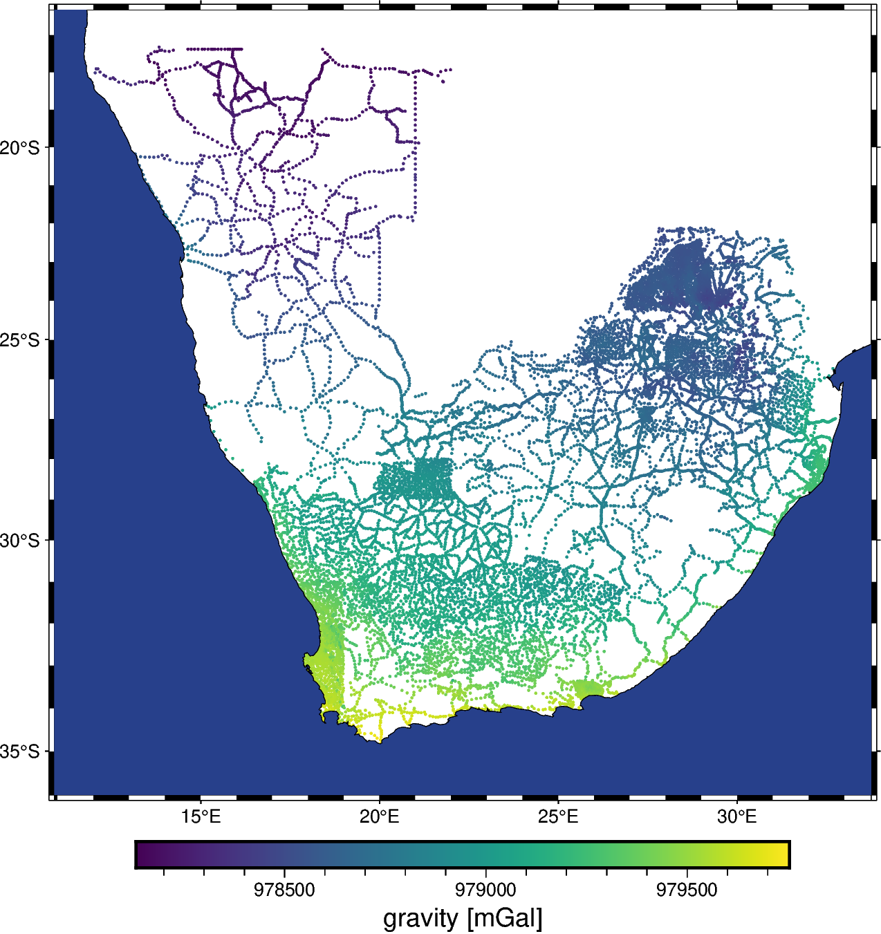
Gravity ground-based surveys of Southern Africa
Note
Click here to download the full example code
Gravity ground-based surveys of Southern Africa
This dataset is a compilation of several public domain ground measurements of gravity from Southern Africa. The observations are the absolute gravity values in mGal. The horizontal datum is not specified and heights are referenced to “sea level”, which we will interpret as the geoid (which realization is likely not relevant since the uncertainty in the height is probably larger than geoid model differences).
Original source: NOAA NCEI
Pre-processing: Source code for preparation of the original dataset for redistribution in Ensaio
import pandas as pd
import pygmt

import ensaio
Download and cache the data and return the path to it on disk
fname = ensaio.fetch_southern_africa_gravity(version=1)
print(fname)
Out:
/home/runner/work/_temp/cache/ensaio/v1/southern-africa-gravity.csv.xz
Load the CSV formatted data with pandas
data = pd.read_csv(fname)
data
Make a PyGMT map with the data points colored by the gravity data.
fig = pygmt.Figure()
fig.basemap(
    region=[
        data.longitude.min() - 1,
        data.longitude.max() + 1,
        data.latitude.min() - 1,
        data.latitude.max() + 1,
    ],
    projection="M15c",
    frame=True,
)
pygmt.makecpt(cmap="viridis", series=[data.gravity_mgal.min(), data.gravity_mgal.max()])
fig.plot(
    x=data.longitude,
    y=data.latitude,
    color=data.gravity_mgal,
    cmap=True,
    style="c0.05c",
)
fig.colorbar(frame='af+l"gravity [mGal]"')
fig.coast(shorelines=True, water="royalblue4", area_thresh=1e4)
fig.show()

Out:
<IPython.core.display.Image object>
Total running time of the script: ( 0 minutes 6.476 seconds)
